Official Project Status Notice — September 21, 2026

Re: Timeline Suspension & Hardware Gating Metrics

Notice is hereby given that all physical field validation operations and upcoming development phases for the 1:1 scale Marconi Wireless Towers reconstruction at Wellfleet, MA, Cape Cod, are placed on hold.

Following the completion of over $3,000,000 in resilient community, public safety, and maritime software applications, this platform has received zero reasonable interest from potential end-users.

While our underlying near-geospatial routing loops, Haversine math, and tripod-stabilized orientation data-smoothing code are mathematically finalized under core commit 86d9474, further field validation and retail hardware deployment are suspended until institutional B2B procurement allocations or hardware pipeline sponsorships are secured by external entities.

The core software technology remains fully compiled, active, and indexed — becoming finalized now as an unassailable wall of permanent public prior art.

Persistent Digital Ledger
Ground Truth
Immutable property history records for municipal verification and insurance claims.
Flood & Disaster Response
Ground Truth
Activates immediately when the grid goes down - first responder property intelligence, flood zone mapping, and offline mesh continuity.
USPS Mobile Mesh
Ground Truth
Postal carrier network integration for real-time address validation and delivery corridor mapping.
NARA Archival Bridge
Ground Truth
National Archives connection for historical property records and civic documentation.
MARA AR/MR Interface
Ground Truth
Augmented reality overlay for on-site property inspection and trade verification.
eVTOL Flight Corridors
Ground Truth
Air mobility pathways coordinated with property infrastructure and rooftop access points.
Humanoid Semantic Mapping
Ground Truth
AI-assisted navigation data for autonomous systems and accessibility routing.
Minuteman Doctrine (250th)
Ground Truth
Patriots Path civic education framework aligned with America 250 commemoration.
Virtual Mailbox (UNM)
Ground Truth
Universal Neighborhood Mailbox - Santa Cruz pilot for digital-physical address unification.
MESA Habitat Audit
Ground Truth
Environmental sustainability assessment for residential and commercial properties.
IDR Infrastructure Debt Recovery
Ground Truth
Municipal finance tracking for infrastructure improvements and assessment bonds.
Persistent Digital Ledger
Ground Truth
Immutable property history records for municipal verification and insurance claims.
Flood & Disaster Response
Ground Truth
Activates immediately when the grid goes down - first responder property intelligence, flood zone mapping, and offline mesh continuity.
USPS Mobile Mesh
Ground Truth
Postal carrier network integration for real-time address validation and delivery corridor mapping.
NARA Archival Bridge
Ground Truth
National Archives connection for historical property records and civic documentation.
MARA AR/MR Interface
Ground Truth
Augmented reality overlay for on-site property inspection and trade verification.
eVTOL Flight Corridors
Ground Truth
Air mobility pathways coordinated with property infrastructure and rooftop access points.
Humanoid Semantic Mapping
Ground Truth
AI-assisted navigation data for autonomous systems and accessibility routing.
Minuteman Doctrine (250th)
Ground Truth
Patriots Path civic education framework aligned with America 250 commemoration.
Virtual Mailbox (UNM)
Ground Truth
Universal Neighborhood Mailbox - Santa Cruz pilot for digital-physical address unification.
MESA Habitat Audit
Ground Truth
Environmental sustainability assessment for residential and commercial properties.
IDR Infrastructure Debt Recovery
Ground Truth
Municipal finance tracking for infrastructure improvements and assessment bonds.
fp NGT Data Engine:LIVE
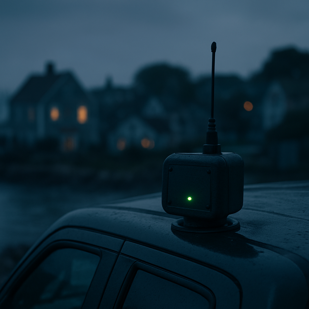
Mesh network field transponder mounted on a vehicle at dusk
Phase 1 — Active Everywhere Now

Build the neighborhood mesh that stays alive when the grid goes dark

Sign up free, drop your pin, and watch the physical safety grid form on the map before any hardware ships. Residents pay $0/mo — own a Baseline Device for $135.

All fp Mesh Networks are connected by the same radio-cellphone hybrid app.

See how the mesh keeps your block connected in an emergency →

No new hardware to start

Your phone is the first node

When the towers go dark, the smartphone already in your pocket keeps working on the mesh. Drop a free pin and your device becomes part of the neighborhood network tonight — the optional $135 Baseline Device simply extends its reach.

Works without service

No cell signal, no Wi-Fi, no problem. Your phone still sends and receives text on the local mesh when the grid is down.

Hops phone to phone

Messages relay device-to-device over short-range Bluetooth and Wi-Fi Direct, so each neighbor's phone passes the signal a little farther.

Transponder extends range

Add the optional $135 Baseline Device once your zone hits density to bridge phone clusters across the whole neighborhood.

The Pre-Order Radar

Every free signup lights up a node. Watch the mesh grid form across the Cape and beyond.

Lower Cape Cod

Forming
Residents3/20
Food trucks0/5

Precedent for mesh reliability, not a description of our deployment

The National University of Singapore, StarHub, ComfortDelGro Bus, and Veniam ran a vehicular wireless mesh pilot at the Kent Ridge campus: on-board units across a fleet of shuttle buses relayed data hop-to-hop when a bus fell outside a fixed node's range, blending DSRC, LTE, and Wi-Fi to keep connectivity intact — later extended to support outdoor connectivity for seniors and IoT health monitoring. That pilot demonstrates multi-hop mesh relaying holds up under real-world mobility, which is a harder problem than Folio-Pin's largely stationary phone-to-repeater network. It is evidence that the underlying relay approach works in the field, not a claim that Folio-Pin's own mesh has been deployed or validated at that scale.

Why being on the map before the storm matters

When the next storm hits, search results change overnight.

Every time a major storm, flood, or hurricane hits a region, homeowners flood Google with searches for roofers, emergency contractors, and disaster response services. The contractors already indexed on folio-pin surface immediately — the ones who signed up after the storm do not.

Pre-indexed, pre-trusted

Folio-pin contractor profiles are already in Google's index with verified location data, permit history, and completed job records. When a homeowner in your town searches 'roof repair after storm' at 11pm, you're already there.

Search volume spikes 10–40×

Local searches for emergency contractors, water damage repair, and tree removal spike sharply in the days after a storm event. folio-pin's verified trade map captures that surge because the data is already structured for local search.

The mesh keeps you reachable

When cell towers go down after a storm, the mesh network keeps neighborhood communication alive — and keeps your contractor listing reachable even when the broader internet is degraded.

What happens in the 48 hours after a storm

Storm hits

Hour 0

Power restored

Hours 2–8

Search surge begins

Hours 4–12

Verified contractors get calls

Hours 6�����24

Contractors on folio-pin

Your verified profile is working 24/7 — before and after every storm.

Drop your free pin on the mesh map, add your trade, and your verified work record is in the index tonight.

Marine safety concept

Marine Aquaculture & Fleet Safety

Lobster trap mapping, ropeless gear syncing, and right whale mitigation for the fleet, plus shark detection and deterrent coordination for swimming areas—one unified mesh.

Open marine safety concept

Phase 1 Digital Mapping is 100% free

Create a free account to drop your dynamic pin, post local jobs, and build your property passport. No hardware required, no monthly fees.

Hardware Tiers

Fleet & Group Packages

From a single wristband to a district-wide fleet — choose the tier that matches how many people you need to protect.

Tier 1

Baseline Device

$135 flat

One wristband, pendant, or dongle transponder with long-range peer-to-peer radio and a lifetime PWA license. Reserve now, ships once your zone hits density.

Tier 2

Family & Friends Defense Circle

$499 upfront, one-time

3x long-range transponder nodes + 2x wearable pendants — enough to cover a household and the people you check on most.

Tier 3

Institutional School District Fleet

$2,500 upfront

+ $299/mo routing & monitoring

10x heavy-duty structural transponders, 20x safety wristbands, and a master control dashboard for district-wide coverage.

How the rollout works

1. Free digital foundation

Residents, artists, and food trucks sign up free and drop pins. Costs you nothing — the cloud maps the exact coordinates of the user base.

2. The hardware waiting queue

Reserve a Window Repeater or Mobile Transponder. The radar lights up with where the grid is forming before any hardware ships.

3. Batch-shipping cadence

When a zone hits critical density (20 residents + 5 food trucks), the cell is authorized and reservations become payable.

4. The Resident Shield

Pay $0 in ongoing fees. Order a Baseline Device for $135. You own the hardware, you own your data, you keep the lifeline alive.